Save The Upper Clutha
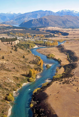
Albert Town is 4 kms downriver from Lake Wanaka, and just a few minutes from the resort town of Wanaka. The proposed Luggate dam would destroy the Upper Clutha River, forming a reservoir from Luggate to the Cardrona River confluence at Albert Town.
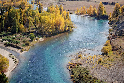
The Upper Clutha Valley has been described as one of the most beautitul valleys in the world. Located between the Southern Alps in the west, and the Central Otago semi-desert in the east, it is a unique environment of ancient glacial terraces divided by the first reaches of the spectacular Clutha River. This river environment is remarkably unspoiled, and is enjoyed by countless thousands of people, especialy in the summer months when the river corridor is frequented by kayakers, triathletes, fishermen (especially fly-fishermen), rafters, jetboaters, pinickers, and trail-users either walking or on mountain-bikes.
Tourist operators regularly guide tourists on the river, fly-fishing (drift-fishing by raft), kayaking (the only guided whitewater kayaking in the South Island), eco rafting (New Zealand's original eco rafting operator), and jetboating. Fly-fishing guides also take clients along the river trails to stalk impressive brown and rainbow trout in crystal clear pools.
Lake Wanaka and the first section of the Clutha River to the Cardrona River confluence (pictured entering here from the left) is protected by the Lake Wanaka Preservation Act (1973). This protection came about after a long but successful struggle by a few Wanaka residents to stop the lake being dammed. Their campaign was called HOWL (Hands Off Wanaka Lake). Today's residents owe their beautiful, natural lake to these passionate individuals. The proposed dam at Luggate would flood the river corridor to approximately the Cardrona River confluence at Albert Town. Flows out of the Cardrona River, the Hawea River, and Lake Wanaka would be slowed when the lakes and rivers are high. This, potentially, poses a serious flood risk to Wanaka and Albert Town.
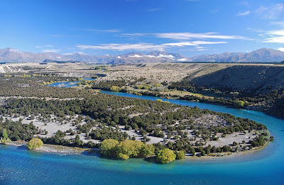
Reko's Point Conservation Area spans a large area of "The Snake" near Luggate. The area gets it name from Reko, the Maori Chief who together with Kaikoura guided Nathaniel Chalmers inland in 1853. Chalmers was the first European to see the Upper Clutha, or Mata-Au. When he became ill near Lake Hawea, he was guided down the Clutha on a mokihi, or Maori raft, navigating the largest rapids in New Zealand en route to the coast, a journey he never forgot.
Today, the Reko's Point track provides easy walking access to this special area. The native ecology is remarkably well preserved, with mature stands of Kanuka, many unique river corridor cushion-fields, and abundant birdlife, especially Fantail (Piwakawaka), who use Reko's Conservation Area as a breeding sanctuary in this often harsh environment.
The Luggate 'Grandview Bridge' is a local icon listed highly in the Queenstown Lakes District Council's Historic Register. It was opened on October 28, 1915, and has been described as "one of the most attractively proportioned steel truss road bridges in the country." It is 103.7 metres long, and features a 61 metre Baltimore through truss, another 30.5m truss and a 12.2m rolled steel joist end span. It is threatened by the proposed Luggate dam.
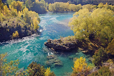
The most dramatic river feature on the Upper Clutha is undoubtedly the remarkable Devil's Nook, or Devil's Elbow. Here, the entire force of the river flows directly against a rock bluff, forming powerful whirlpools, as the river changes direction. This is thought to be the most extreme high volume switchback in the world. It is a popular area for locals who like to walk, picnic, fish, boat and swim in the area (in a few secluded and safe swimming-holes).
The Upper Clutha River corridor has extraordinary natural, recreational and tourism values, especially important to the local communities of Wanaka and Luggate. The proposed Queensberry and Luggate dams would convert the wild Upper Clutha River into two lifeless reservoirs.


